The coordinate information of GID is now available!
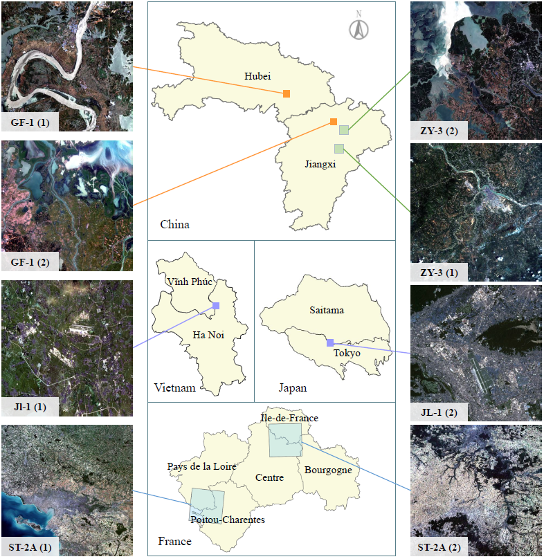
In recent years, large amount of high spatial-resolution remote sensing (HRRS) images are available for land-cover mapping. However, due to the complex information brought by the increased spatial resolution and the data disturbances caused by different conditions of image acquisition, it is often difficult to find an efficient method for achieving accurate land-cover classification with high-resolution and heterogeneous remote sensing images. In this paper, we propose a scheme to apply deep model obtained from labeled land-cover dataset to classify unlabeled HRRS images. The main idea is to rely on deep neural networks for presenting the contextual information contained in different types of land-covers and propose a pseudo-labeling and sample selection scheme for improving the transferability of deep models. To pre-train deep model specific to HRRS images, we create a large-scale land-cover dataset containing 150 Gaofen-2 satellite images. Experiments on multi-source HRRS images, including Gaofen-2, Gaofen-1, Jilin-1, Ziyuan-3, Sentinel-2A, and Google Earth platform data, show encouraging results and demonstrate the applicability of the proposed scheme to land-cover classification with multi-source HRRS images.
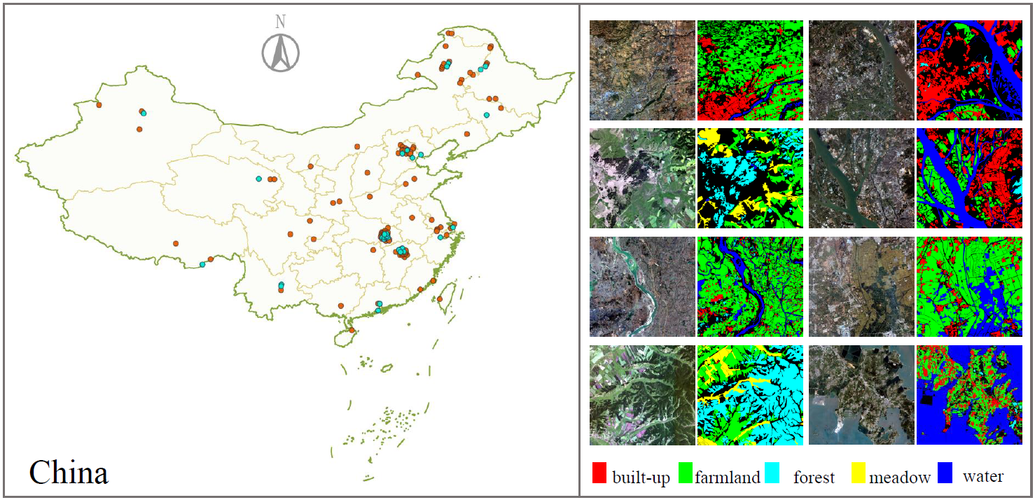
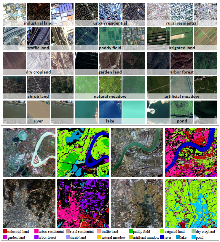
We construct a large-scale land-cover dataset with Gaofen-2 (GF-2) satellite images. This new dataset, which is named as Gaofen Image Dataset (GID), has superiorities over the existing land-cover dataset because of its large coverage, wide distribution, and high spatial resolution. GID consists of two parts: a large-scale classification set and a fine land-cover classification set. The large-scale classification set contains 150 pixel-level annotated GF-2 images, and the fine classification set is composed of 30,000 multi-scale image patches coupled with 10 pixel-level annotated GF-2 images. The training and validation data with 15 categories is collected and re-labeled based on the training and validation images with 5 categories, respectively.
The GID dataset is released under the open source license. It can be downloaded from Google Drive or Baidu Drive:
A dataset extended on GID is available at Five-Billion-Pixels.
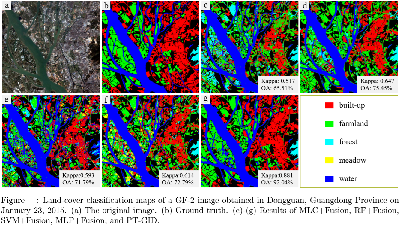
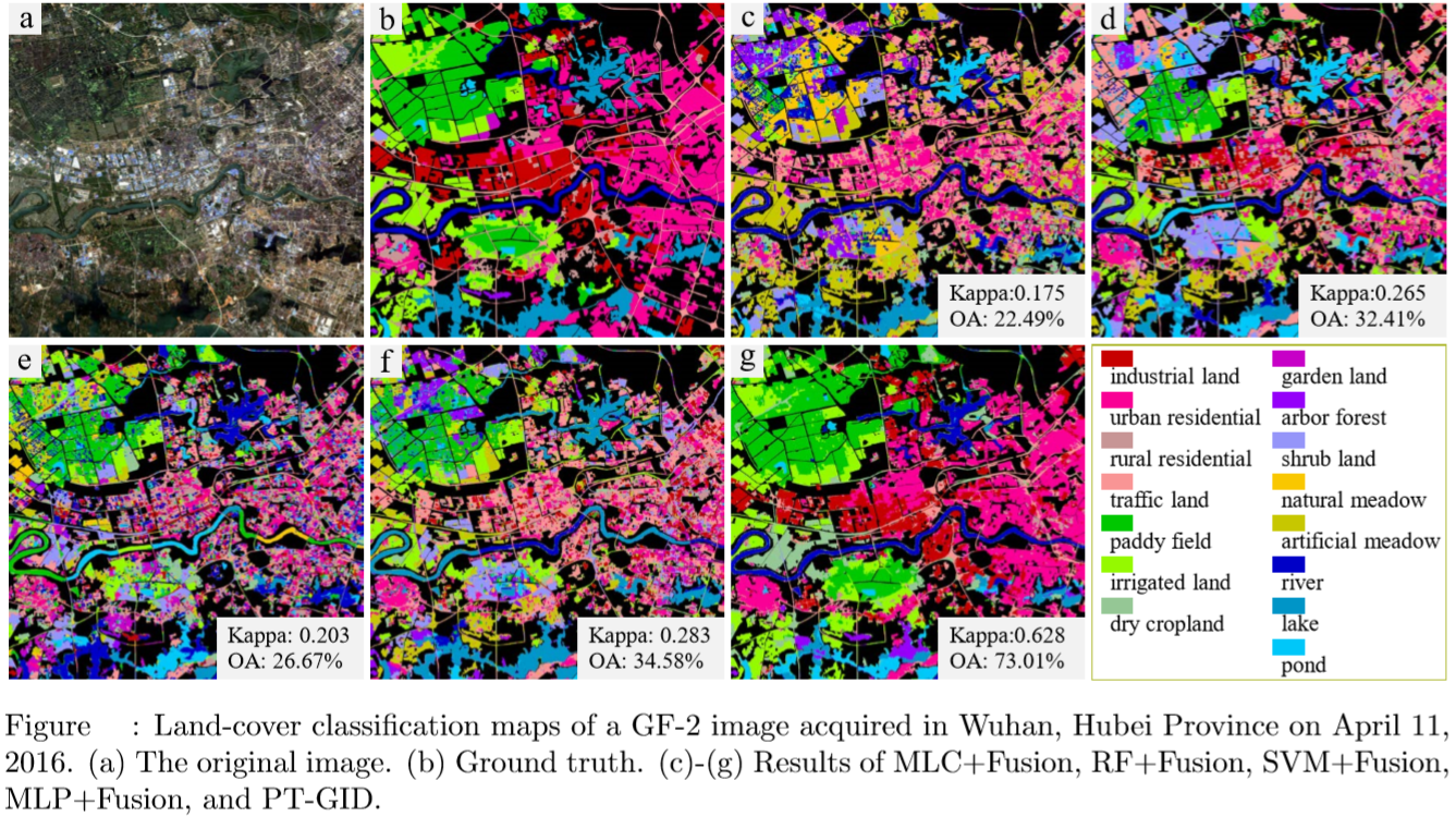
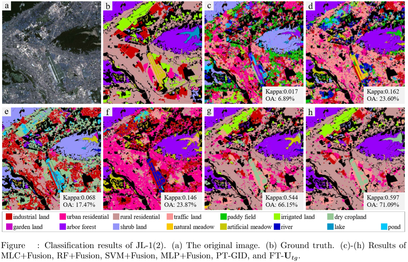
We test our algorithm and analyse the experimental results in this section. Two types of land-cover classification issues are examined: 1) transferring deep models to classify HRRS images captured with the same sensor and under different conditions, 2) transferring deep models to classify multi-source HRRS images. For performance comparison, several object-based land-cover classification methods are utilized.
@article{GID2020,
  title={Land-cover classification with high-resolution remote sensing images using transferable deep models},
  author={Tong, Xin-Yi and Xia, Gui-Song and Lu, Qikai and Shen, Huanfeng and Li, Shengyang and You, Shucheng and Zhang, Liangpei},
  journal={Remote Sensing of Environment},
  volume={237},
  pages={111322},
  year={2020}
}
E-mail: xytong@mit.edu
Personal page: Xin-Yi Tong